Walking tour : Le Praz de Lys via Les Pavés
Add to my favorites

Route opened
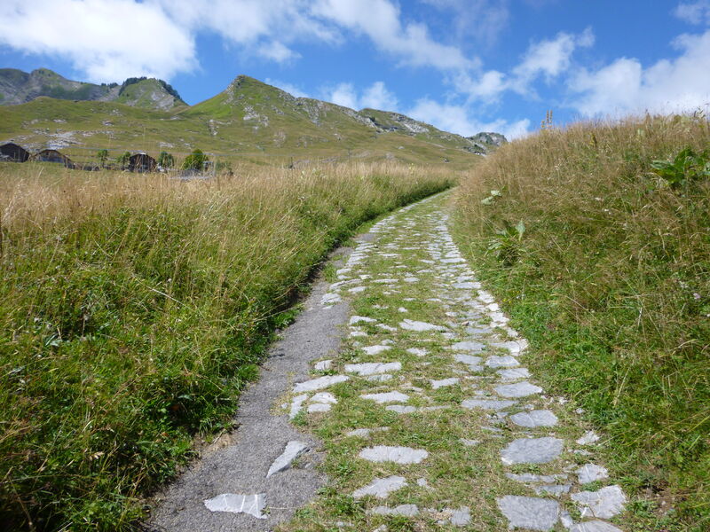
These stones were laid according to Roman techniques and the path was first used in the Middle Ages by the monks from the Chartreuse de Mélan to access Praz de Lys pastures 1,000m further up. For a long time, this was the only access to Praz de Lys.
The characteristics of the route.

Taninges (74)
- Distance 12.1 km
- Elevation gain 900 m
- Elevation lost 900 m
- Min. elevation 643 m
- Max. elevation. 1525 m
- Duration (depending on pace) 4h50
- Marking Yes
Along this itinerary, the landscapes are varied, between the villages, forests and pastures, as well as some magnificent viewpoints from the heights of Taninges and Praz de Lys, over the Mont-Blanc and Chablais mountains.Marking : Departmental signposting on beige metal panels with green lettering.Equipments : Car park, Public WC, Admission fee : Free access.Opening : From 15/05 to 15/11.
Subject to favorable snow and weather conditions.
Read before you go!
Adapt your equipment to your level and the weather. Stay on the marked trails.
Adapt your equipment to your level and the weather. Stay on the marked trails.
Area : Taninges
Report a problem
Website Le Praz de Lys par les Pavés Pdf file
Add your time and share your feelings


Information updated on 2025-05-30 by Conseil Départemental de la Haute-Savoie


Follow us on
the digital trails
the digital trails


![]()
Infos & contacts
Praz de Lys Sommand Tourisme
www.prazdelys-sommand.com
04.50.34.25.05
accueil@prazdelys-sommand.com
 Praz de Lys Sommand - Grandeur Nature - Parcours - Walking tour : Le Praz de Lys via Les Pavés
Hello, world! This is a toast message.
Praz de Lys Sommand - Grandeur Nature - Parcours - Walking tour : Le Praz de Lys via Les Pavés
Hello, world! This is a toast message.
Praz de Lys Sommand - Grandeur Nature - Parcours - Walking tour : Le Praz de Lys via Les Pavés
Hello, world! This is a toast message.


OK
Annuler