Tour of Haute Pointe
Add to my favorites

Route opened
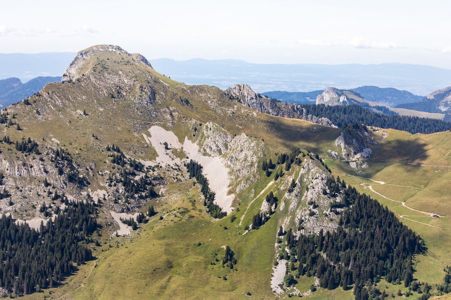
On this pleasant walk, you will be exploring the lush-green mountainside pastures around this fantastic staggering peak.
The characteristics of the route.
Mieussy (74)
- Distance 8.4 km
- Elevation gain 510 m
- Elevation lost 510 m
- Min. elevation 1412 m
- Max. elevation. 1811 m
- Duration (depending on pace) 3h30
- Marking Yes
Besides the green pastures of Chablais, this trail also offers a magnificent viewpoint over the Sommand Plateau, Mont-Blanc mountains and the other surrounding peaks.Equipments : Car park, Admission fee : Free access.Opening : From 15/05 to 15/11.
Subject to favorable snow and weather conditions.
Read before you go!
Adapt your equipment according to your level and the weather. Stay on the marked trails.
Adapt your equipment according to your level and the weather. Stay on the marked trails.
Area : Sommand
Report a problem
Tour de Haute Pointe Pdf file Pdf file
Add your time and share your feelings


Information updated on 2025-05-30 by Praz de Lys Sommand Tourisme


Follow us on
the digital trails
the digital trails


![]()
Infos & contacts
Praz de Lys Sommand Tourisme
www.prazdelys-sommand.com
04.50.34.25.05
accueil@prazdelys-sommand.com
 Praz de Lys Sommand - Grandeur Nature - Parcours - Tour of Haute Pointe
Hello, world! This is a toast message.
Praz de Lys Sommand - Grandeur Nature - Parcours - Tour of Haute Pointe
Hello, world! This is a toast message.
Praz de Lys Sommand - Grandeur Nature - Parcours - Tour of Haute Pointe
Hello, world! This is a toast message.


OK
Annuler