Giffre Cycling Loop
Add to my favorites

Route opened
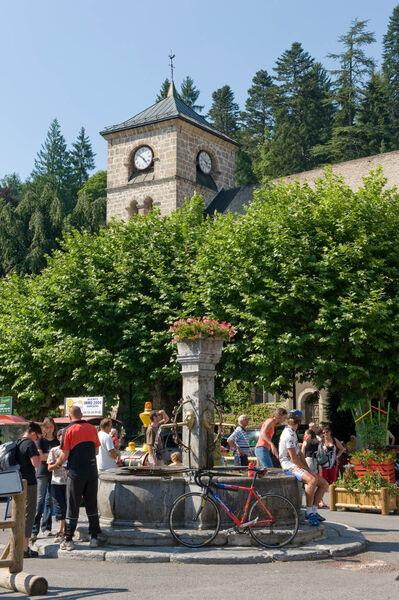
A tour to explore a beautiful pre-Alpine valley accessible via the Petit Col de Châtillon. Stop in Taninges to listen to the largest carillon in Haute-Savoie (Thursdays only).
The characteristics of the route.

Cluses (74)
- Distance 41.3 km
- Elevation gain 490 m
- Elevation lost 490 m
- Min. elevation 479 m
- Max. elevation. 737 m
- Marking No
Direction of the route: clockwise
Landmarks and connections: Châtillon-sur-Cluses; Taninges (where it branches off from the Ramaz Circuit No. 38 and the Joux-Plane Circuit No. 36); Samoëns (where it splits from the Fer-à-Cheval Round Trip No. 40)
Description: The Giffre is the main tributary of the Are and one of the most abundant rivers in France relative to its size. This is due to the heavy rainfall and snowfall that occur in the Pre-Alpine massif it drains. It is in May, June, and July, during peak snowmelt, that you’ll see the most water in its bed—excluding sudden flash floods caused by thunderstorms. The proposed route allows you to explore both sides of the middle Giffre Valley. To get there, you’ll first need to cross the Col de Châtillon. After the descent, you’ll cross the river and arrive in Taninges, whose bell tower houses the largest carillon in Haute-Savoie. You’ll hear it if you pass through on Thursday, market day. Also worth seeing are the contemporary art exhibitions held in Taninges at the Chartreuse de Mélan. The route continues along the right bank to Samoëns, where you’ll switch to the other side of the river. After returning to the “other side,” you’ll cross the Col de Châtillon again, with a gentler climb.Admission fee : Free access.Opening : From 15/04 to 31/10 daily.
Landmarks and connections: Châtillon-sur-Cluses; Taninges (where it branches off from the Ramaz Circuit No. 38 and the Joux-Plane Circuit No. 36); Samoëns (where it splits from the Fer-à-Cheval Round Trip No. 40)
Description: The Giffre is the main tributary of the Are and one of the most abundant rivers in France relative to its size. This is due to the heavy rainfall and snowfall that occur in the Pre-Alpine massif it drains. It is in May, June, and July, during peak snowmelt, that you’ll see the most water in its bed—excluding sudden flash floods caused by thunderstorms. The proposed route allows you to explore both sides of the middle Giffre Valley. To get there, you’ll first need to cross the Col de Châtillon. After the descent, you’ll cross the river and arrive in Taninges, whose bell tower houses the largest carillon in Haute-Savoie. You’ll hear it if you pass through on Thursday, market day. Also worth seeing are the contemporary art exhibitions held in Taninges at the Chartreuse de Mélan. The route continues along the right bank to Samoëns, where you’ll switch to the other side of the river. After returning to the “other side,” you’ll cross the Col de Châtillon again, with a gentler climb.Admission fee : Free access.Opening : From 15/04 to 31/10 daily.
Area : Taninges
Report a problem
Website Pdf file Giffre Loop
Add your time and share your feelings


Information updated on 2024-12-10 by Conseil Départemental de la Haute-Savoie


Follow us on
the digital trails
the digital trails




Infos & contacts
Praz de Lys Sommand Tourisme
www.prazdelys-sommand.com
04.50.34.25.05
accueil@prazdelys-sommand.com
 Praz de Lys Sommand - Grandeur Nature - Parcours - Giffre Cycling Loop
Hello, world! This is a toast message.
Praz de Lys Sommand - Grandeur Nature - Parcours - Giffre Cycling Loop
Hello, world! This is a toast message.
Praz de Lys Sommand - Grandeur Nature - Parcours - Giffre Cycling Loop
Hello, world! This is a toast message.


OK
Annuler