Tour des Alpages du Giffre
Add to my favorites

Route opened
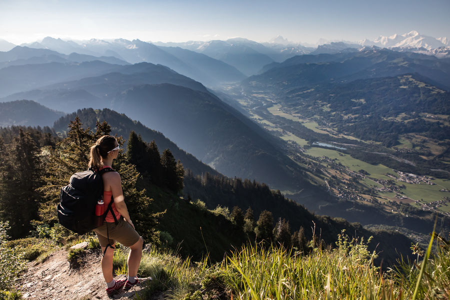
Around the communes of Taninges, Samoëns, Sixt-Fer-à-Cheval, Verchaix with a detour to Les Gets, explore the trails of this tour of the Giffre mountain pastures at your own pace, in one or more stages, alone, with family or friends.
The characteristics of the route.
Taninges (74)
- Distance 89.8 km
- Elevation gain 4600 m
- Elevation lost 4600 m
- Min. elevation 618 m
- Max. elevation. 1809 m
- Marking Yes
Discover authentic places in sublime natural panoramas.
Let yourself be tempted by the many local and farm products on offer along the way!Equipments : Car park, Admission fee : Free access.Opening : From 15/05 to 15/11. Subject to favorable snow and weather conditions.
Let yourself be tempted by the many local and farm products on offer along the way!Equipments : Car park, Admission fee : Free access.Opening : From 15/05 to 15/11. Subject to favorable snow and weather conditions.
Read before you go!
Adapt your equipment according to your level and the weather. Stay on the marked trails.
Adapt your equipment according to your level and the weather. Stay on the marked trails.
Area : Mieussy
Report a problem
Add your time and share your feelings


Information updated on 2025-05-30 by Praz de Lys Sommand Tourisme


Follow us on
the digital trails
the digital trails


![]()
Infos & contacts
Praz de Lys Sommand Tourisme
www.prazdelys-sommand.com
04.50.34.25.05
accueil@prazdelys-sommand.com
 Praz de Lys Sommand - Grandeur Nature - Parcours - Tour des Alpages du Giffre
Hello, world! This is a toast message.
Praz de Lys Sommand - Grandeur Nature - Parcours - Tour des Alpages du Giffre
Hello, world! This is a toast message.
Praz de Lys Sommand - Grandeur Nature - Parcours - Tour des Alpages du Giffre
Hello, world! This is a toast message.


OK
Annuler